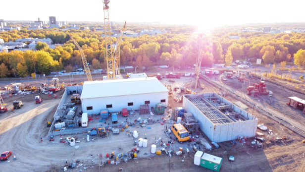
The construction landscape is undergoing significant change, driven by the integration of advanced drone technologies. Initially used for experimental aerial photography, drones have quickly become a crucial part of modern construction workflows worldwide.
In 2025, commercial drones equipped with systems like photogrammetry and LiDAR are not just supplementary tools—they are fundamentally transforming project execution from start to finish.
At construction sites across the nation, these aerial platforms offer unparalleled visibility and data collection capabilities. The market reflects this transformation: the construction drone industry was valued at $3.9 billion in 2023 and is projected to grow at an 8.5% CAGR through 2032. This growth results from tangible improvements in project delivery—clients and developers are demanding the enhanced accuracy and efficiency that drone integration provides.
While traditional site monitoring required teams to physically traverse hazardous areas for basic visual assessments, drones now capture comprehensive aerial data in minutes rather than hours. This shift is not just about convenience; it represents a fundamental change in how we gather, process, and utilize site intelligence to advance construction operations. For developers and property owners, this means more informed decisions, reduced uncertainties, and ultimately, better-built environments.
What Are the Key Benefits of Using Drones in Construction?
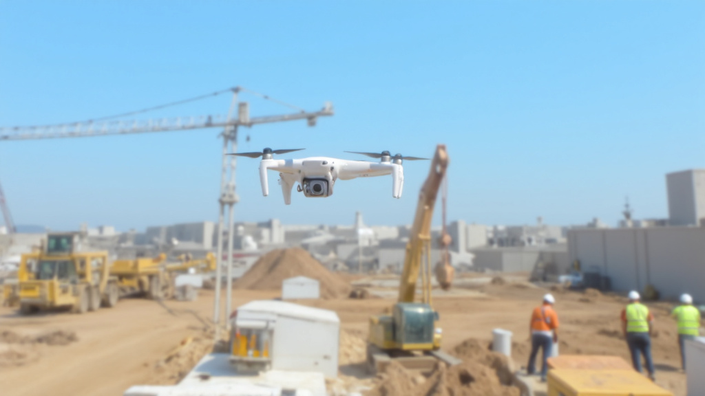
Drone technology has revolutionized our approach to construction management and civil engineering projects. These aerial tools have become essential as we seek to optimize workflow, enhance safety, and deliver projects with greater precision.
Accelerated Data Collection and Site Surveying
Incorporating drone technology into our workflow at EB3 Construction has dramatically reduced our survey timelines. Drone systems complete comprehensive site surveys 60-70% faster than traditional land-based methods, allowing us to gather critical topographic data without the delays typically associated with manual surveying.
When preparing for the groundbreaking of a multi-acre commercial development last month, our drone survey captured detailed elevation changes across challenging terrain in just hours—work that would have taken days using conventional methods. This rapid data acquisition enables us to accelerate pre-construction planning and respond more quickly to developer timelines.
The high-resolution imagery and LiDAR capabilities of modern construction drones deliver remarkably detailed mapping and topographical models. We use this enhanced data to create more accurate CAD drawings and GIS applications, establishing a solid foundation for project planning and execution.
Significant Cost Reduction
We have identified substantial cost savings through strategic drone implementation. Rather than mobilizing full technical inspection teams for routine assessments, our drones can perform preliminary inspections with minimal personnel. This approach proves particularly valuable when examining tall structures, building facades, and roofing systems where traditional inspections would require expensive scaffolding, lifts, or cranes.
Beyond immediate equipment savings, we are capturing efficiencies through reduced labor hours and compressed inspection schedules. A drone inspection of a six-story structure’s exterior can be completed in hours rather than the days required for traditional methods, allowing us to identify construction issues earlier and avoid costly rework.
The efficiency translates to meaningful budget impacts across large-scale projects where comprehensive documentation and frequent progress checks are essential. Our clients appreciate these savings, which we can pass along through more competitive pricing structures.
| Aspect | Traditional Inspections | Drone-Based Inspections |
|---|---|---|
| Time Efficiency | Typically requires days | Completed in hours |
| Cost Efficiency | Higher due to equipment and labor | Lower due to reduced manpower and equipment |
| Safety | Higher risk due to physical access | Lower risk with remote operation |
| Data Accuracy | Subjective and prone to errors | High-resolution, accurate data |
| Access to Hard-to-Reach Areas | Requires scaffolding or lifts | Accessible via aerial view |
Enhanced Jobsite Safety
Worker safety is our paramount concern, and drone technology has significantly improved safety profile.
We have eliminated the need for team members to physically access hazardous locations like steep roofs, unstable terrain, and confined spaces for routine inspections. This reduction in exposure to fall risks alone justifies our investment in drone systems.
Beyond the prevention of immediate safety incidents, the reduced physical strain on our inspection teams has decreased workplace injuries and fatigue-related issues. Our safety record has improved measurably since integrating drones into our standard operations.
Improved Communication and Collaboration
Perhaps the most transformative aspect of drone implementation has been the enhancement of communication efficiency—by up to 65% according to industry studies. We leverage real-time video feeds to share visual site conditions with project stakeholders, eliminating misunderstandings that often arise from verbal descriptions or static photographs.
Drone footage can be used during weekly progress meetings, enabling remote stakeholders to virtually “walk the site” without travel. This visual transparency fosters better collaboration between architects, engineers, and construction teams, with decisions made faster and with greater confidence.
The rich visual documentation proves invaluable for resolving disputes and validating work progress. When questions arise about site conditions or installation quality, we reference our drone documentation rather than relying on memory or written reports alone, bringing unprecedented clarity to project discussions.
Comprehensive Documentation and Progress Tracking
We have elevated our project documentation standards through systematic drone surveys. Regular aerial monitoring creates a visual timeline of construction progress, allowing us to compare actual site conditions against projected schedules and identify potential delays before they impact critical path activities.
These comprehensive visual records serve multiple purposes beyond active construction management. They provide valuable documentation for permit inspections, insurance requirements, and warranty considerations. The ability to demonstrate precisely how a project evolved from groundbreaking to completion adds significant value for our development clients.
In an industry where documentation can make the difference between profitable projects and costly disputes, our drone-based visual records provide an objective, indisputable record of site conditions throughout the construction process.
How Are Drones Being Applied in Construction Projects?
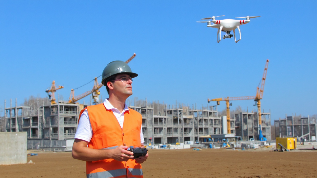
In the evolving construction landscape, drones have transitioned from novelty gadgets to essential tools that transform project management and execution. We have integrated drone technology across our operations to provide exceptional visibility and data-driven decision-making for our clients.
BIM Integration and Digital Twin Creation
We use LiDAR-equipped drones to capture highly accurate data that integrates seamlessly with our Building Information Modeling systems. These advanced sensors collect point cloud data—even in low-light conditions—providing precise spatial information that underpins our digital planning process.
By overlaying drone-captured 3D models on our original BIM plans, we identify discrepancies between design intent and actual construction in real-time. This enables our project managers to make immediate adjustments rather than discovering issues during later stages when corrections become more costly. The integration has been particularly valuable since the 2023 updates to AIA contract documents that emphasize digital deliverables.
The resulting digital twins serve as living documents throughout the project lifecycle, from initial planning through handover and facility management. When working with complex geometries or on sites with significant grade changes, this technology has been invaluable in maintaining alignment between design vision and physical reality.
Site Planning and Progress Documentation
Drone photogrammetry has transformed our approach to site planning. By capturing hundreds of high-resolution images from various angles, we generate detailed topographical models that reveal site conditions undetectable from ground level. This process, once requiring weeks of traditional surveying, now takes hours.
Our regular flight schedules—typically bi-weekly on major projects—create a chronological record of construction progress that serves multiple functions. For developers and property owners, these visual records provide irrefutable documentation of milestone completion and work quality. For our superintendents, they offer comprehensive site visibility that informs daily coordination and sequencing decisions. The efficiency gains are substantial.
| Phase | Drone Application | Deliverables |
| Pre-Construction | Site surveying and mapping | Topographic maps, 3D models |
| Construction | Progress monitoring, safety inspections | Aerial imagery, inspection reports |
| Post-Construction | Marketing and documentation | Aerial photography, project documentation |
Construction Monitoring and Risk Mitigation
We conduct regular drone inspections to identify potential safety hazards that might go unnoticed from ground level. Thermal imaging capabilities allow us to detect electrical hotspots in newly installed systems, potential water intrusion, or inadequate insulation—all before they become costly problems. This proactive approach to quality control has significantly reduced our rework rates.
Material management has similarly been transformed. Our drones provide accurate volumetric measurements of stockpiles, enabling precise tracking of aggregate materials, soil removal, and other bulk supplies. When excavation or earthwork is underway, we monitor cut-and-fill progress daily, making real-time adjustments to equipment deployment based on productivity data rather than estimates.
Equipment tracking via aerial imagery helps us optimize fleet utilization across large sites. By analyzing movement patterns and idle time, we’ve improved equipment efficiency on major projects, directly reducing operational costs that would otherwise be passed to our clients.
Client Communication and Stakeholder Engagement
For developers and property owners, maintaining visibility into project progress is crucial. Our drone program delivers professional-grade documentation that keeps stakeholders informed without requiring constant site visits. Monthly progress reports include annotated aerial imagery that clearly communicates construction status against the planned schedule.
The visual nature of drone footage has proven particularly effective when communicating with non-technical stakeholders who may struggle to interpret traditional construction documentation. During public meetings or investor presentations, these assets help build confidence in project execution and timeline adherence.
Even in the pre-construction phase, we use drones to capture existing conditions that inform design decisions and help visualize the finished project in its environment. This approach has been particularly valuable for urban infill projects where surrounding context significantly impacts design decisions.
Quality Assurance and Comprehensive Inspections
Before final completion, we conduct comprehensive aerial inspections of building envelopes, roofing systems, and site work. These inspections often reveal issues invisible from the ground, such as improper flashing, ponding on flat roofs, or inconsistent site drainage patterns. Addressing these items before occupancy prevents warranty claims and enhances building performance.
The efficiency of drone inspections has been particularly valuable for large-footprint structures like warehouses or retail developments. What once required multiple days of manual inspection can now be completed in hours, with better documentation and more consistent results.
Beyond construction completion, many of our clients continue to utilize drone services for periodic facility management inspections. By establishing baseline conditions at handover, these programs help property managers maintain building integrity and plan maintenance interventions before systems fail.
As drone technology continues to evolve, we remain committed to incorporating innovations that enhance our ability to deliver projects safely, efficiently, and with the highest quality standards. The integration of artificial intelligence for automated defect detection and autonomous flight capabilities promises to further transform how we manage construction in the coming years.
What Types of Drones Are Used in Construction?
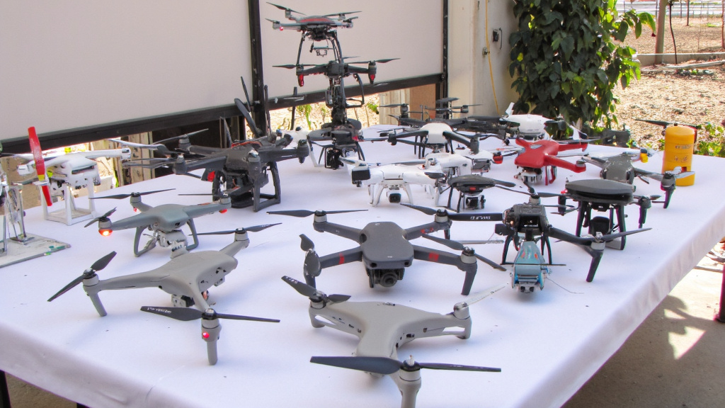
We have integrated various drone technologies to enhance project delivery and monitoring capabilities. Selecting the right drone type is crucial for maximizing efficiency and data quality across different construction applications. Each type offers distinct advantages that we leverage for specific project requirements.
Multi-rotor Drones: Versatile Workhorses
Multi-rotor drones constitute approximately 80% of all drones deployed on construction sites—and for good reason. These compact, maneuverable platforms excel in close-range operations where precision matters. Typically featuring 4-8 rotors, they provide exceptional stability for detailed inspections and surveillance tasks.
We frequently use multi-rotors for building façade inspections and site monitoring, as their ability to hover in place allows us to capture detailed imagery of specific structural elements. Their compact design makes them easy to transport between job sites, and their intuitive controls mean even team members with minimal training can operate them effectively after proper safety briefings.
The primary limitation of multi-rotors is their relatively short flight time, typically around 30 minutes per battery charge. This necessitates careful mission planning when covering larger areas—something our field teams have become adept at managing through systematic flight patterns and battery rotation protocols.
Fixed-Wing Drones: Long-Range Surveyors
For larger construction projects spanning several acres, we turn to fixed-wing drones. These aircraft-like units offer significantly longer flight times—often 2-3 hours compared to a multi-rotor’s 30 minutes. Their aerodynamic design and efficient power usage make them ideal for comprehensive site surveys and topographic mapping of extensive development areas.
Fixed-wing drones fly at higher speeds and altitudes, efficiently capturing data across broader areas in a single flight. We find them particularly valuable during pre-construction phases when accurate terrain modeling influences critical decisions about earthwork volumes and site preparation costs.
The trade-off comes in their operational requirements. Fixed-wing drones need substantial space for takeoff and landing, making them less practical for confined urban construction sites. They also require more specialized piloting expertise, which is why we maintain dedicated operators specifically trained for these systems.
VTOL (Vertical Take-Off and Landing) Hybrids: Best of Both Worlds
The evolution of drone technology has produced impressive VTOL hybrid models that combine fixed-wing efficiency with multi-rotor flexibility. These sophisticated platforms take off and land vertically like multi-rotors but transition to efficient forward flight once airborne.
Our experience with models like the WingtraOne has demonstrated their value for medium to large projects where launch space is limited but coverage requirements are substantial. Their extended flight times—typically 60-90 minutes—and the ability to deploy from confined spaces make them increasingly important tools in our construction monitoring arsenal.
The JOUAV CW series exemplifies the capabilities of modern VTOL drones, with models offering flight times ranging from 120-240 minutes and payload capacities up to 8kg. This allows for integration of specialized sensors beyond standard cameras, including LiDAR systems for precision elevation mapping.
| Type of Drone | Advantages | Disadvantages | Applications |
|---|---|---|---|
| Fixed-Wing Drones | Longer flight times, covers large areas quickly, stable in windy conditions | Requires runway for take-off, limited maneuverability, higher cost | Large-scale surveys, aerial inspections |
| Rotary-Wing Drones | Vertical take-off and landing, easier to operate | Shorter flight times, affected by wind | Close-range inspections, confined spaces |
| Hybrid Drones | Versatile, combines benefits of fixed-wing and rotary-wing | Complex operation, higher cost | Large-scale surveys, detailed data collection |
Helicopter Drones: Specialized Applications
Though less common on construction sites, single-rotor helicopter drones offer certain advantages for specialized applications. Their more efficient energy usage translates to longer flight times and improved payload capacity compared to similar-sized multi-rotors.
We use helicopter drones in situations requiring heavier sensor packages or extended monitoring periods. However, their complexity of operation and higher skill requirements for pilots limit their everyday utility compared to more accessible drone types.
Key Manufacturers and Models
The construction drone ecosystem is dominated by several major manufacturers, each offering platforms suited to different construction applications. DJI leads the market with its Phantom and Matrice series, while specialized mapping needs are often met by purpose-built systems from Wingtra and JOUAV.
For routine site documentation and progress monitoring, we frequently deploy the DJI Phantom 4 RTK, which offers centimeter-level positioning accuracy without requiring extensive ground control points. For more complex mapping operations across larger sites, the fixed-wing capabilities of systems like the Microdrones mdMapper or JOUAV CW-15 provide the range and endurance needed for comprehensive data collection.
The drone market continues to evolve rapidly, with advancements in flight time, sensor technology, and autonomous capabilities emerging regularly. We continuously evaluate new platforms to ensure our construction operations benefit from the most effective aerial data collection tools available, matching each drone type to the specific requirements of our diverse construction projects.
The Future of Drones in Construction
The construction industry is on the brink of a technological transformation as drone technology evolves and reshapes project delivery. Market projections indicate impressive growth—from $4.8 billion in 2024 to $6.2 billion by 2030—highlighting the potential of these aerial tools. As general contractors, we have already integrated drone technology into our daily operations, and the ongoing evolution suggests even greater possibilities ahead.
The combination of traditional construction expertise with advanced technologies like photogrammetry and LiDAR is unlocking unprecedented opportunities. Previously expensive technology is becoming more accessible to firms of all sizes. This democratization of aerial data collection allows us to provide clients with more accurate estimates, reduce costly rework, and deliver projects with greater precision. The recent supply chain challenges during the pandemic have accelerated the adoption of these technologies as construction companies seek ways to maintain productivity despite labor shortages.
Streamlined Integration and Data Management
The future isn’t just about better drones—it’s about their seamless integration with other construction technologies. Current data bottlenecks between drone surveys and actionable information will dissolve as cloud computing and edge processing advance. We are already benefiting from faster data processing that allows us to analyze drone imagery on-site rather than waiting days for processed results. These improvements enable our team to make critical decisions faster and with more confidence.
As construction professionals, we are particularly excited about the integration of AI-powered analysis tools that can automatically identify safety hazards, track material usage, and verify construction quality. These capabilities will transform how we manage quality control and site safety, allowing our superintendents to focus on critical path activities rather than routine inspections.
Expanding Applications in Specialized Construction
While current drone applications focus primarily on surveying and monitoring, we anticipate their use will expand into specialized construction tasks. The development of drones capable of carrying larger payloads and operating with greater precision will enable applications from installing components in hard-to-reach areas to performing inspection and maintenance tasks on tall structures. These advances will significantly reduce the risks associated with working at heights—a key consideration as we prioritize worker safety.
The regulatory environment is also evolving to accommodate these new capabilities. The FAA’s incremental approach to beyond visual line of sight (BVLOS) operations is creating a pathway for more sophisticated drone applications that don’t require constant human supervision. This regulatory progress, combined with technological advances, will enable contractors like us to deploy drones more extensively throughout project lifecycles.
At EB3 Construction, we recognize that staying at the forefront of drone technology isn’t just about having the latest equipment—it’s about strategically applying these tools to deliver better value to our clients. As we continue to integrate drone capabilities into our workflows, we remain committed to using these innovations to enhance project outcomes rather than simply adopting technology for its own sake.
The construction industry has traditionally been slow to embrace technological change, but drones represent a rare exception—a technology that offers immediate benefits while promising even greater returns in the future. By maintaining our focus on practical applications that deliver real value to our clients and projects, we are positioning ourselves to leverage the full potential of this transformative technology.
Connect with us today to discuss how our forward-thinking approach to construction technology can benefit your next project. Contact EB3 Construction and discover how we’re building tomorrow’s solutions today.
