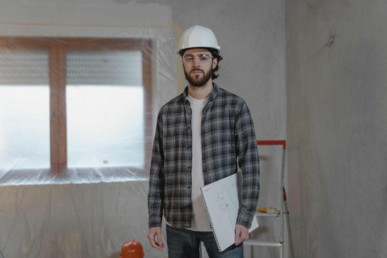
As a general contractor serving the Dallas-Fort Worth metroplex, we collaborate closely with construction surveyors on virtually every project we undertake. These specialized professionals are the essential first step in our construction process, establishing the precise reference points and measurements that guide our entire build. Construction surveyors translate architectural blueprints into real-world coordinates, ensuring our foundations, structural elements, and site improvements are positioned exactly where they need to be.
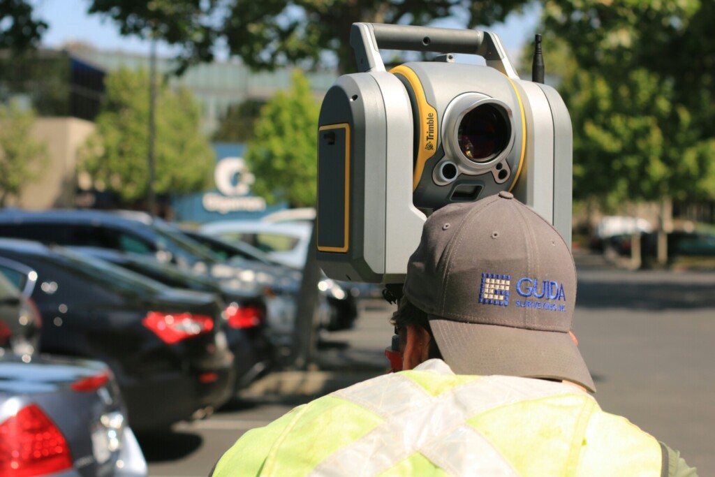
Working alongside our project managers, construction surveyors deploy sophisticated technology, including robotic total stations, laser levels, and GPS systems, to map boundaries and create accurate site layouts. When we break ground on a new commercial building or begin infrastructure work, these professionals have already marked the terrain with stakes, flags, and reference points that our excavation and concrete teams will follow with precision. The margin for error in modern construction is exceptionally narrow, particularly in Dallas’s booming development market.
The construction landscape in Dallas presents unique challenges for surveying work. With the region’s clay-heavy soils, varying elevations, and strict municipal requirements, we rely on surveyors who understand local conditions and compliance standards. Their initial site analysis, boundary verification, and elevation benchmarks establish the framework upon which we build. From the North Dallas Corridor to downtown’s commercial district, accurate surveying prevents costly mistakes and ensures our structures align perfectly with existing infrastructure and property lines.
What Services Do Dallas Construction Surveyors Provide?

At EB3 Construction, we collaborate closely with specialized construction surveyors to deliver precise commercial projects throughout Dallas. These partnerships are crucial as we transform architectural plans into physical reality. The surveying services we integrate into our construction process provide the foundation for every successful commercial development.
Concrete Layout Services
Before pouring foundations or installing hardscapes, we ensure precise concrete layout services for parking lots, driveways, and sidewalks. Our surveying partners establish the exact horizontal and vertical positioning needed for proper drainage slopes and ADA compliance. This precision is especially important during Dallas’s heavy rainfall events, where improper concrete grading can lead to costly water intrusion issues.
We regularly coordinate with surveyors who use robotic total stations and GPS technology to transfer design elevations from blueprints to physical stake markers. These markers guide our concrete crews during forming and pouring operations, maintaining millimeter-level accuracy that prevents future structural issues.
Topographic and Site Surveying
A comprehensive site assessment begins with topographic surveying that maps existing terrain conditions. We rely on these detailed surveys to identify drainage patterns, soil conditions, and potential challenges before excavation begins. Recent changes to Dallas’s stormwater management regulations have made these surveys even more critical to compliance.
The surveying data collected helps our project managers make informed decisions about cut-and-fill requirements, retaining wall placements, and soil stabilization needs. When redeveloping older commercial sites, these surveys often reveal unexpected underground conditions that require proactive solutions before they become costly problems.
Utility Layout and Coordination
Effective utility management starts with precise utility layout services. We work with surveyors to map existing utilities and stake locations for new installations, preventing costly and dangerous utility strikes. This process has become increasingly complex in Dallas’s dense commercial corridors, where multiple utility systems often occupy crowded underground spaces.
By integrating utility survey data into our construction sequence, we maintain safer excavation practices and reduce the risk of service disruptions to neighboring properties. Our construction teams use these marked layouts to coordinate with utility providers during critical connection phases.
| Firm | Services Offered | Technology Utilized | Specialization |
|---|---|---|---|
| GeoSurvey, Ltd. | Construction layout for buildings, curbs, storm and sewer drainage systems | N/A | Residential subdivisions and various commercial projects |
| BFA, Inc. | Construction surveys (staking) | N/A | Laying out and staking buildings, curbs, and gutters |
| Allen & Co. | Comprehensive surveying services | Robotic total stations, GPS systems | All sizes of commercial construction projects |
Construction Technology Integration
Modern construction surveying extends beyond traditional field work into technology integration. We incorporate surveyor-generated CAD files with precise calculations into our Building Information Modeling (BIM) systems. This digital integration allows for virtual construction testing before physical work begins, identifying potential conflicts between structural elements and mechanical systems.
These detailed digital models serve as the backbone for our quality control processes, allowing field teams to verify actual construction against design specifications in real-time. When variations are detected, we can implement corrective measures before they escalate into larger construction issues.
Specialized Layout Services
Commercial projects often require specialized layout services tailored to specific construction phases. We coordinate demolition layout management for renovation projects, ensuring precise identification of structures to be removed while protecting elements that must remain intact. For new construction, building layout services establish exact footings and foundation locations according to architectural specifications.
Environmental compliance remains a priority, which is why we integrate erosion control layout services into our site management plans. These layouts guide the installation of silt fencing, retention ponds, and other measures that protect Dallas watersheds from construction runoff while keeping our projects compliant with local regulations.
Why Are Construction Surveyors Essential for Dallas Projects?
Construction surveyors provide essential services, ensuring legal boundaries are respected and structures comply with local codes. Without proper surveying, projects risk encroaching on neighboring properties, potentially leading to costly legal disputes that can halt construction entirely. These professionals establish the precise spatial relationships that form the foundation of every successful construction project.
Streamlining Dallas Permitting and Compliance
In Dallas’s complex regulatory environment, accurate surveying directly supports smoother permitting processes. When comprehensive survey documentation accompanies building permit applications, city officials can quickly verify compliance with setback requirements, height restrictions, and zoning ordinances. This thoroughness often leads to faster approvals and construction starts, especially valuable in Dallas’s competitive development landscape.
Construction teams rely on surveyors to establish benchmark elevations and coordinate systems that maintain compliance throughout the building process. These reference points guide foundation work, structural installation, and final inspections, ensuring the finished structure adheres to the approved plans. The precision provided by professional surveyors significantly reduces the risk of stop-work orders or failing final inspections due to boundary or elevation discrepancies.
Preventing Costly Errors and Delays
Construction errors resulting from inaccurate site information can lead to serious financial consequences. When surveyors identify potential issues like subsurface utilities, drainage patterns, or unstable soil conditions before breaking ground, plans can be adjusted accordingly, rather than encountering problems mid-construction. This proactive approach prevents the rework, schedule delays, and budget overruns that plague poorly surveyed projects.
The importance of precision is especially evident in dense urban areas where property lines may be irregular or contested. Surveyors provide detailed documentation of existing conditions, establishing clear boundaries that protect both the developer and neighboring property owners. Their certification offers legal protection and evidence should boundary disputes arise during or after construction.
Supporting Comprehensive Project Execution
From initial site assessment through project completion, surveyors provide continuous quality control to ensure construction accuracy. During earthwork and site preparation, regular surveying confirms proper grading and drainage implementation. As vertical construction progresses, surveyors verify that structural elements are positioned exactly as designed, maintaining plumb, level, and square throughout the building process.
The detailed property records generated through professional surveying also create long-term value for property owners. These documents clearly define easements, rights-of-way, and other legal encumbrances affecting future development potential. For large-scale Dallas projects, particularly those involving multiple parcels or phased construction, comprehensive surveying establishes a coordinated reference framework that keeps all contractors working from consistent, accurate information.
| Milestone | Description |
|---|---|
| Foundation Inspection | Verification of proper footing depths, reinforcement placement, and soil conditions |
| Framing Inspection | Examination of structural integrity and compliance with engineering specifications |
| Mechanical, Electrical, and Plumbing Inspections | Verification of installation accordance with code requirements |
| Fire Safety Inspections | Examination of sprinkler systems, alarm installations, and emergency routes |
| Final Occupancy Inspection | Comprehensive inspection for compliance with codes and plans before occupancy |
While the upfront investment in thorough surveying may seem substantial, the protection it provides against construction errors far outweighs the cost. By establishing precise measurements and reliable documentation from the outset, we create the solid foundation that every successful construction project requires. In Dallas’s complex, fast-paced construction market, professional surveying is not merely a regulatory requirement—it’s an essential risk management strategy that protects the interests of all project stakeholders.
What Technology Do Dallas Construction Surveyors Use?
At EB3 Construction, we utilize advanced surveying technology that transforms our approach to construction projects. Our precision instruments enable us to deliver exceptional accuracy for our development partners throughout Dallas and beyond. Simple transit and tape measure operations are now obsolete—today’s construction surveying incorporates sophisticated digital solutions that significantly enhance project outcomes.
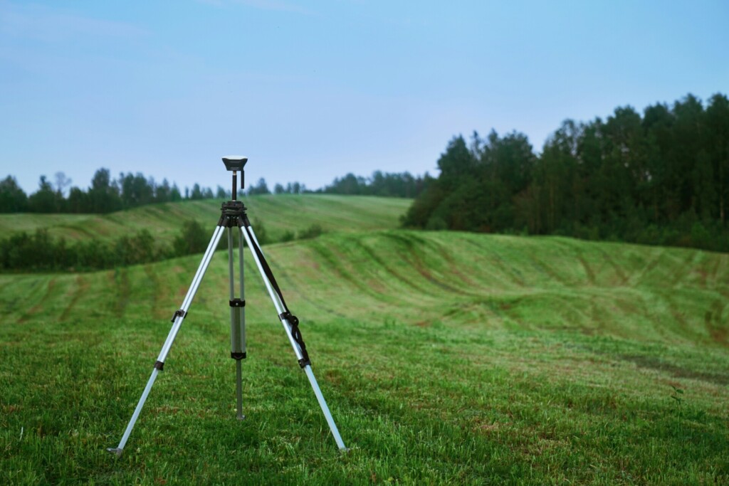
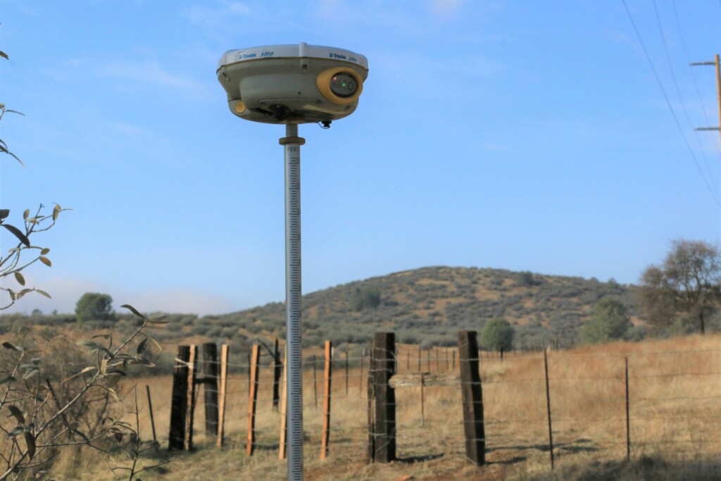
GPS Systems: The Backbone of Modern Surveying
Global Positioning Systems form the foundation of our surveying toolkit. These systems allow us to establish precise boundary locations and elevations with centimeter-level accuracy. When we stake out a new building footprint or utility corridor, our GPS equipment creates a digital framework that guides each construction phase.
The real advantage comes when we integrate GPS data directly into our project management systems. This seamless data flow ensures that information collected in the field is immediately available to project managers, architects, and other stakeholders. Our clients particularly value how this reduces the delay between surveying activities and construction implementation.
During challenging weather conditions or in dense urban environments where satellite signals might be compromised, we supplement GPS with additional reference stations to maintain accuracy standards that meet or exceed industry requirements. This redundancy ensures we deliver reliable measurements regardless of field conditions.
Robotic Total Stations: Precision in Motion
Robotic total stations are another critical component of our surveying arsenal. These sophisticated instruments combine electronic distance measurement with angular measurement capabilities, allowing a single surveyor to collect hundreds of precise data points in far less time than conventional methods.
The tracking capabilities of our robotic instruments mean we can maintain continuous measurement during dynamic construction operations. For concrete pours and structural steel placement, this real-time verification capability proves invaluable. We position these instruments strategically around active work zones to monitor critical elevations and alignments as construction progresses.
For developers and property owners, this translates directly to cost savings. The efficiency gained through robotic surveying equipment results in fewer personnel hours on-site while maintaining exceptional quality control. When we verify building corner locations or check floor elevations, data collection is swift without sacrificing accuracy.
3D Scanning and Data Integration
When projects involve existing structures or complex topography, we employ 3D scanning technology to create comprehensive digital models. These detailed scans capture millions of measurement points, generating “point clouds” that represent every surface and feature with remarkable precision.
After collecting field data, our team processes this information using specialized software that converts raw measurements into actionable construction documentation. The resulting 3D models integrate seamlessly with BIM (Building Information Modeling) systems, creating a digital twin of the project that guides construction activities with exceptional clarity.
For renovation projects, this technology is particularly valuable. We can precisely document existing conditions before work begins, identifying potential conflicts between new design elements and existing structures. This proactive approach helps us avoid costly mid-construction adjustments that would otherwise impact project schedules and budgets.
| Technology | Description | Advantages | Use in Dallas Construction |
|---|---|---|---|
| 3D Laser Scanning (LiDAR) | Uses laser beams to measure distances and create 3D models of the environment | High precision and speed; versatile for new developments and retrofits | Provides accurate data for complex commercial developments |
| Drone (UAV) Surveying | Utilizes unmanned aerial vehicles to capture high-resolution aerial imagery | Cost-effective and quick; provides aerial perspective | Useful for large or hard-to-access properties |
| GIS Technology | Analyzes and visualizes spatial data through interactive maps | Data integration, zoning, and environmental analysis | Ensures project alignment with zoning and land use laws |
| GPS Surveying | Utilizes satellite signals to provide precise location data | High accuracy and speed; flexible for various terrains | Defines property boundaries accurately |
| BIM Integration | Integrates 3D modeling and design data into a single platform | Enhances collaboration and provides comprehensive visualization | Improves planning and efficiency for multi-story buildings |
Field-to-Office Workflow
The true power of modern surveying technology emerges in our streamlined field-to-office workflow. Data collected on construction sites transfers wirelessly to our project management systems, eliminating transcription errors and reducing processing time. This connectivity ensures everyone working on a project has access to the same accurate information.
We’ve built robust verification protocols into this workflow to maintain data integrity. Multiple checkpoints and quality control measures ensure that measurements meet stringent accuracy standards before becoming part of the official project record. When measurements appear questionable, our surveyors immediately investigate and resolve discrepancies rather than allowing errors to propagate through the construction process.
This technological integration creates tangible benefits for our clients. Construction proceeds with greater confidence, reducing rework and keeping projects on schedule. The digital documentation we generate also provides valuable records for future reference, should questions arise about as-built conditions or property boundaries.
How to Choose a Construction Surveyor in Dallas
Selecting the right construction surveyor for your Dallas project involves careful consideration of various critical factors. We have collaborated with numerous developers and property owners who recognize that quality surveying forms the foundation of successful construction. The ongoing construction boom across North Texas has increased the demand for qualified surveyors, making your selection process even more crucial.
Verify Experience and Credentials
We recommend examining a surveyor’s track record with similar construction projects. A qualified construction surveyor should demonstrate proficiency in projects comparable to yours. Ask potential firms about their specific experience with commercial or industrial developments similar to your planned construction.
Professional credentials are essential in this field. All surveyors should be properly licensed and certified in Texas. Look for firms where surveyors hold current certifications and regularly engage in continuing education to stay up-to-date with industry standards and technologies. Companies that invest in their surveyors’ professional development typically deliver superior results.
Request references from past clients, particularly those with projects in the Dallas area. Speaking with previous customers provides insight into the surveyor’s reliability, communication style, and ability to meet deadlines—all crucial factors when construction timelines depend on accurate survey work.
Evaluate Technical Capabilities
Modern surveying demands sophisticated equipment and techniques. We have found that firms utilizing advanced GPS systems and robotic total stations typically deliver more precise measurements with greater efficiency. Ask potential surveyors about their technical capabilities and how they apply these tools to ensure accuracy.
The quality of deliverables is critical in construction surveying. Request samples of previous work to assess the level of detail and clarity in their documentation. Comprehensive, well-organized survey reports and drawings reduce the risk of costly construction errors and delays.
Consider the surveyor’s ability to handle specialized requirements. Some construction projects need unique surveying approaches based on site conditions or project specifications. Firms with diverse technical expertise can adapt their methods to meet your specific needs rather than applying a uniform approach.
| Criterion | Description |
|---|---|
| Experience and Credentials | Verify specific experience with similar projects and ensure professional licensing and certifications in Texas. |
| Technical Capabilities | Assess the use of advanced GPS systems and robotic total stations and the quality of deliverables. |
| Local Knowledge | Ensure familiarity with Dallas-specific regulations and conditions, including zoning and flood plain designations. |
| Responsiveness | Choose a surveyor known for clear communication and realistic timelines. |
| Value Beyond Price | Focus on comprehensive service packages and long-term relationship potential rather than just the lowest bid. |
Assess Local Knowledge and Responsiveness
Local expertise offers significant advantages when navigating Dallas-specific regulations and conditions. Surveyors familiar with local zoning requirements, flood plain designations, and historical property records can anticipate and address potential issues before they impact your construction timeline.
Turnaround time directly affects project scheduling. Construction delays often begin with survey delays, so prioritize firms that commit to realistic timeframes and have a reputation for meeting deadlines. Ask about their current workload and capacity to take on your project without compromising quality or timeliness.
Strong communication practices indicate professional reliability. The best surveying firms maintain clear, consistent communication throughout the project. They should be readily accessible to answer questions, provide updates, and address concerns as they arise. This responsiveness becomes particularly valuable when unexpected issues require quick resolution.
Consider Value Beyond Price
While budget considerations matter, the lowest bid rarely represents the best value in construction surveying. Evaluate the comprehensive service package rather than focusing solely on price. Quality surveying prevents expensive construction errors and rework, ultimately saving money throughout the project’s lifespan.
Customer service significantly impacts your project experience. Look for firms that demonstrate genuine interest in understanding your specific project requirements. Personalized attention indicates a commitment to addressing your unique needs rather than applying standardized solutions that might miss critical details.
Long-term relationship potential offers additional value for developers with multiple projects. Surveyors who become familiar with your standards and preferences can work more efficiently on future projects. Consider whether the firm has the capacity and stability to support your development needs beyond the current project.
Conclusion: Finding the Right Construction Surveyor for Your Dallas Project
In Dallas construction projects, surveyors provide the precision and compliance essential for project success. We have seen how quality surveying enhances project delivery, offering the accurate measurements and documentation necessary for structures to meet exact specifications. By collaborating with experienced surveyors who use advanced GPS technology and robotic instruments, we consistently achieve better outcomes for our clients.
Successful construction projects in Dallas start with correct site layout and precise topographic data. Whether developing commercial real estate, planning industrial facilities, or managing infrastructure work, the quality of your surveying team significantly influences construction feasibility, timeline adherence, and budget control. By partnering with surveying professionals familiar with Dallas-specific requirements and equipped with specialized expertise, we ensure smoother progress from initial planning through to completion.
Want to provide your next Dallas construction project with a precise foundation? Contact us at EB3 Construction to discuss your project needs.